
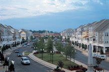
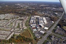
Birkdale will eventually be connected to the Mecklenburg Country Trailways system. McDowell Creek which runs right behind Birkdale is part of that plan. Above is the map of the Birkdale Village piece of the trail that will incorporate our current pond walkway and will run right behind the movie theater. Here is the link to Mecklenburg County's McDowell Creek Page and Map:
This section of the Greenway will initially run 1.5 miles from West Moreland Road to Sam Furr. It will connect Birkdale, Stratford Forest, the future Robbin's Park, and the Alexander Chase neighborhood. The design is largely complete and they should start construction this summer.
I wrote Jason Pauling, Mecklenburg County's Greenway Planner, to suggest that the trail might be better off running beside the village along the gas line that runs between the village itself and the Greens at Birkdale Houses. Here is his great response:
"Thank you for your email and questions. The issues at Sam Furr relate to the fact that we will not be able to go under Sam Furr at this time due to the fact that the box culverts are too small, plus we do not own any land next to the creek and would have a tough time trying to get through the Birkdale golf course. Therefore, the best crossing would be at the intersection of Birkdale Commons Parkway and Sam Furr Road as you have mentioned. We would most likely widen the sidewalk along Sam Furr, which is currently 5-feet wide and separated from the road by a planting strip. We have not researched the possibility of using the gas easement, but I will do that and let you know if it looks feasible. Birkdale Commons Parkway contains sidewalk and bike lanes, and is a good overland connector for the greenway to continue. The next leg of McDowell after that will most likely extend from the end of Birkdale Commons Parkway, back to the creek, and then run behind the Wynfield neighborhood toward Gilead Road, where it will connect to the Torrence/Lower McDowell Creek system."
I also asked about a future possible connection to the northcross shopping center and eventually to the light rail stop at Sam Fur/73 and 115. Can you say weekend morning walks to the Bagel Bin? He replied:
"As far as a connection to Northcross, there is a tributary of McDowell Creek called Caldwell Station Creek that runs behind the Northcross Center. Not sure if it runs all the way to 115, but it gets close. I think that developing a greenway along this tributary is something that would be in the Town of Huntersville and Town of Cornelius Greenway Master Plan. It's a good idea, although getting under I-77 would be a challenge and major cost factor. Check with Michael Jaycocks with the Town of Huntersville Park and Rec. dept. to see if this creek is in their master plan. His number is 704-766-2228. In the meantime, We will be improving the existing boardwalk/bridge crossing at Townley Road, which will provide a connection to Northcross Drive, where there is a CATS Park and Ride lot. By using the greenway and the boardwalk/bridge, you would avoid having to get on Sam Furr Road. Safety of bicyclists and pedestrians, and connections to a number of destinations is our primary goal."
I look forward to the day a few years from now when I could
eventually Bike for miles on the interconnected Greenway system of Mecklenburg County.


No comments:
Post a Comment